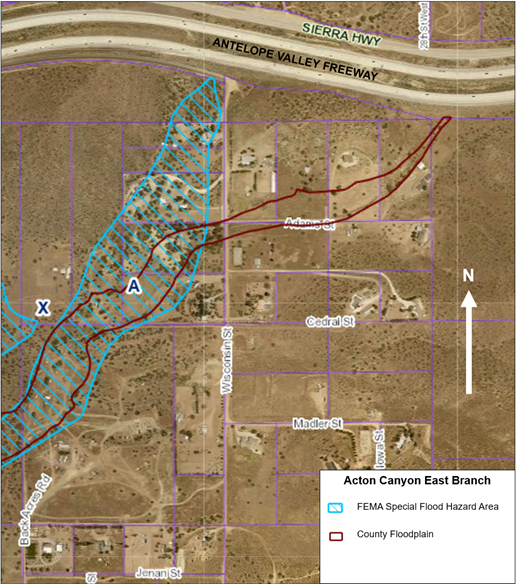
Los Angeles County Public Works is initiating a drainage study to pursue a Letter of Map Revision (LOMR) for two of the Federal Emergency Management Agency's (FEMA's) Flood Insurance Rate Maps (FIRMs) in a neighborhood in the east branch of Acton Canyon. The purpose of the LOMR is to more accurately identify Special Flood Hazard Areas (SFHAs) and define Base Flood Elevations to better inform residents of flood risk in this neighborhood, and help with their flood insurance premiums. At this time, Public Works does not expect the drainage study to identify increased flood risk to existing structures or the need for increased floodplain development restrictions in the neighborhood.
Notification letters have been sent to the affected property owners and nearby residents to inform them of the drainage study and the presence of Public Works staff and its consultants in the neighborhood. Public Works anticipates completing the drainage study and submitting a LOMR application to FEMA in summer 2026, and FEMA issuing the LOMR within 12 months after Public Works' submittal. The LOMR will become effective for insurance purposes 3 to 6 months from the date of FEMA's issuance of the LOMR.
Affected property owners and residents will be notified when Public Works submits the LOMR application and when FEMA issues the LOMR.
Here is a link to Acton Canyon Frequently Asked Questions Sheet
Check back with this web page for updates on the Acton Canyon East Branch LOMR process.
For questions, please email us at floodanalysis@dpw.lacounty.gov.