

ON THIS PAGE
Rosemead Boulevard Complete Street Improvements Phase I
Project Overview
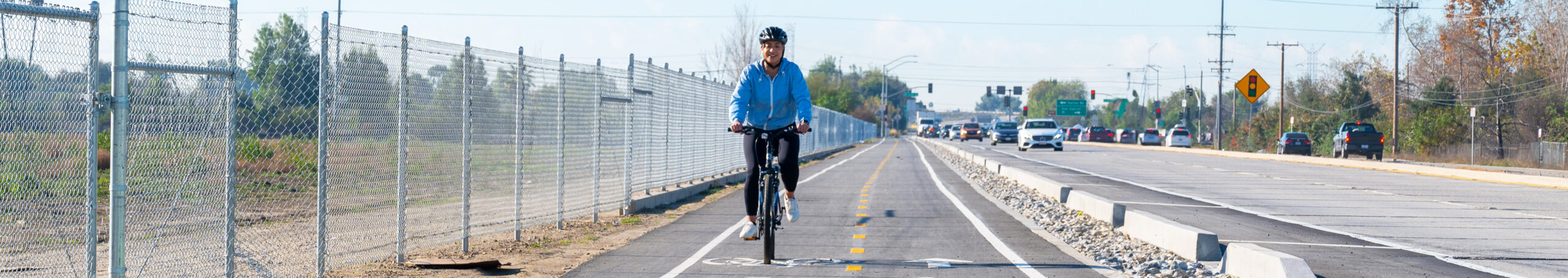
Public Works is developing a pre-design project report for a complete streets treatment on a 2.6-mile segment of Rosemead Boulevard (Bl). The project, officially known as the Rosemead Boulevard Complete Street Improvements Phase I, is a six-lane divided highway with no bike facilities and isolated sidewalk segments on the overcrossing for the State Route 60 Freeway. Currently, pedestrians and bicyclists must use the roadway shoulder to travel along this corridor, which presents a challenge and limits residents and visitors from traveling along the corridor using these modes of transportation. As a result, the majority of visitors primarily drive to the park. The lack of bike and pedestrian infrastructure prevents convenient access for those users to most of the park’s facilities. The Project will provide a solution to this problem and increase the mobility options for all users.
Partnership with Caltrans
Although the majority of the project is within County jurisdiction, there is a portion that involves Caltrans. Public Works and Caltrans are collaborating to develop the scope and design of the portion of the project at the State Route 60 Freeway interchange. This portion is within Caltrans jurisdiction and requires approval from Caltrans.”
Project Goals
The Project seeks to accomplish the following goals:
- Support the County’s efforts towards Vision Zero initiative
- Create new bicycle and pedestrian facilities to separate users from vehicular traffic
- Address infrastructure gaps created by lack of sidewalks
- Provide continuous pedestrian network from South El Monte to Pico Rivera
- Improve access to key destinations
- Improve wayfinding signage throughout corridor
- Enhance access to transit
- Improve access to nearby bike trails including the Rio Hondo and San Gabriel River, and the trails within the Whittier Narrows Recreation Area
Once complete, the Project will link nearby residents living in South El Monte and Pico Rivera to the project area to park space and regional bicycle paths, inviting more residents to utilize the facilities and engage in physical activity.
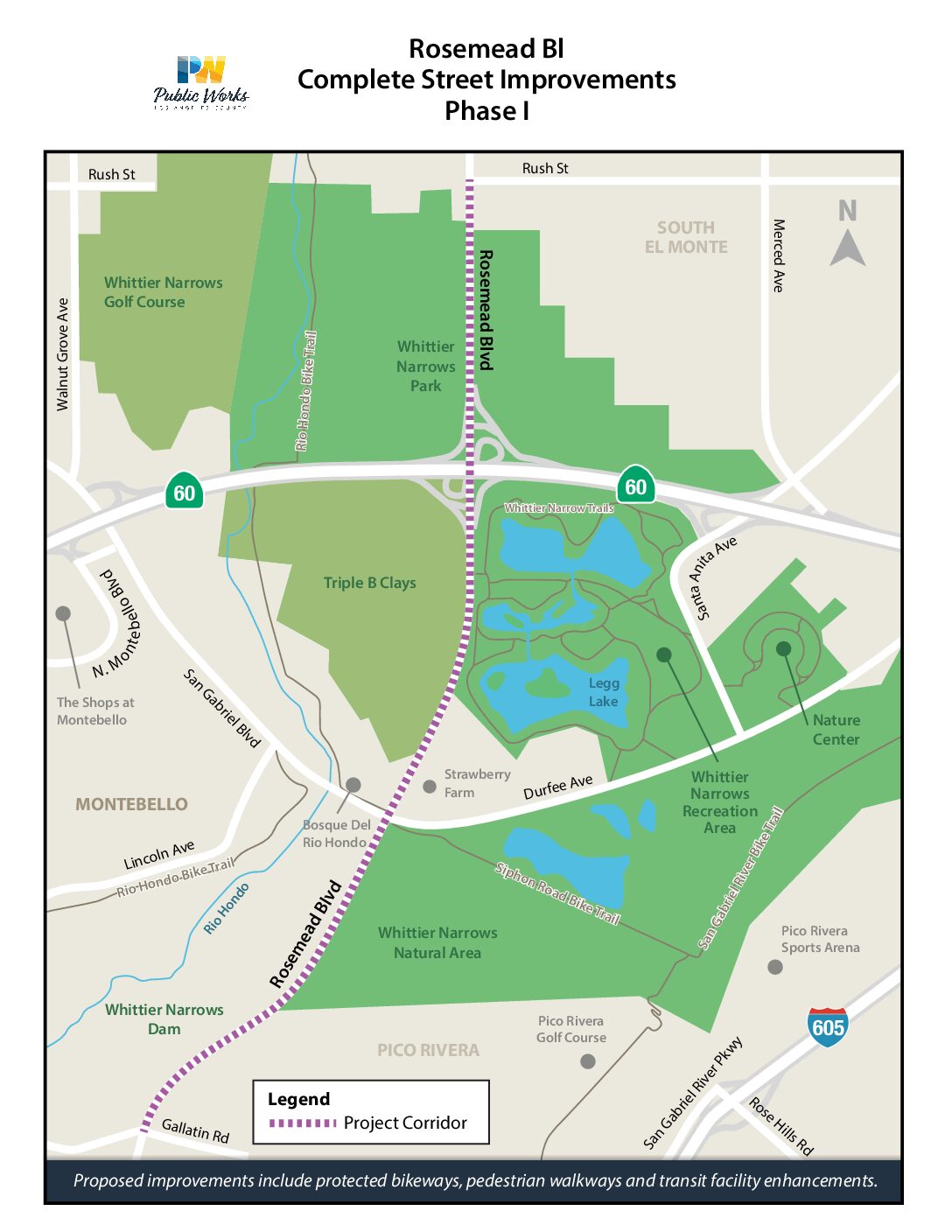
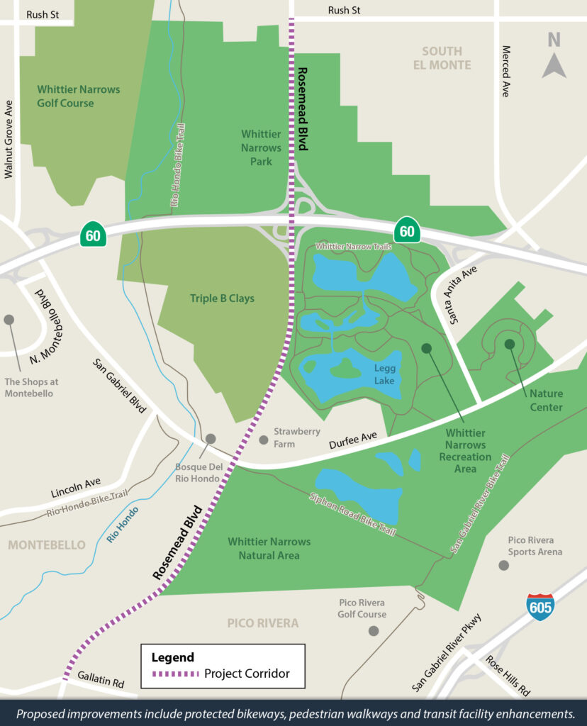
Project Location Area
The Project is located along Rosemead Bl in unincorporated Los Angeles County, between Rush Street in the City of South El Monte and Gallatin Road in the City of Pico Rivera. Within these parameters, the corridor traverses the Whittier Narrows Recreation Area, which receives over two-million annual visitors and hosts numerous large-scale events as well as private events year-round.
Meetings
Public input is vital to the successful development of this project. Follow this page for meeting updates.
Past Meetings
Saturday February 15, 2025
10:00 AM – 11:30 AM
Pico Rivera Library
9001 Mines Ave
Pico Rivera, CA 90660
Presentation Link
Caltrans Presentation
Flyer
Meeting Comments Link
Tuesday December 5, 2017
6:00pm – 8:00pm
Pico Rivera Golf Course
3260 Fairway Dr.
Pico Rivera, CA 90660
Meeting Materials:
Agenda (English/Spanish)
Presentation
Boards

Contact Us
Helpline: (714) 599-3545